You read that right … we receive 650 Billion* with a B gallons of rainfall on average every year. That much water weighs 5.5 trillion pounds! Mind blowing numbers to say the least.
With all of this water falling on just Thurston County each year, you would think that we would be completely inundated. But not so.
Ninety-seven percent of our runoff flows into the Pacific Ocean

The goal of every rain drop is to get back to the sea as fast as possible. In the case of our County, 97 percent of this water falls as rain and is not stored as snow as it is in counties that have higher elevation mountains. This means that almost all of this water is able to get to work immediately flowing back down to Puget Sound or out to the Pacific Ocean if it is in the Chehalis River drainage system. That is a good thing and it is why we hardly notice it because it doesn’t stick around long after it hits the surface.
*That’s using the average rainfall of 52 inches over an area of about 750 sq. miles. Also, of course, it varies depending on total rainfall we actually get so in a drought year like 2015 we received roughly 470 Billion Gallons. That is 180 Billion gallons less than the average.
A day in the life of rain…
Let’s take a journey with some water on its cycle from sea to land and back to the sea again.
 Stage 1: Our raindrops start their journey in the Pacific Ocean
The Pacific is the origin of almost all precipitation we receive in Western Washington. From the surface of the ocean, the sun’s energy is absorbed by the water and is warmed to the point where individual water molecules are able to pull away from those around them and become airborne (evaporation).
They rise up with the air currents and eventually become clouds as they once again change into a liquid from a vapor form. Water is what is called a tri-phasic substance meaning it has three different forms it can exist in depending on temperature and pressure. It can be a gas/vapor, a liquid or a solid/ice.
They are pure water and have left all of the dissolved salts and impurities behind in the ocean (this is why oceans get saltier over time). They begin to collect into larger clouds and then weather systems and so on into storms. These storms are brought over our region by strong air currents called the Jet Stream.
The air rises as it encounters the Olympic and Cascade Mountains and is forced up over the mountains causing it to cool. This cooling causes the water droplets and water vapor to form larger drops that are too heavy remain in the air any longer and they fall as rain drops.
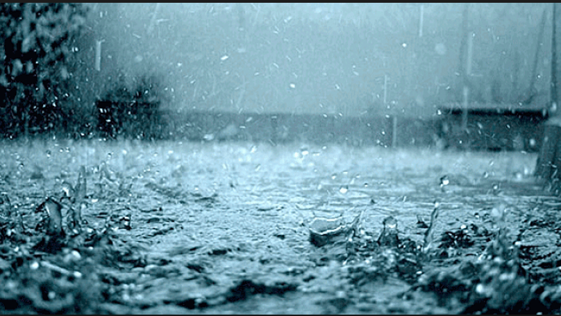
Stage 2: Touchdown
Raindrops impact the ground and begin to collect on the land surface and within the upper soil layers. Sometimes it’s in the form of snow in higher elevations but usually it’s rain in Thurston County.
Once the water is back on the ground after having travelled in the air for hours, weeks, or even years, it is immediately on its way back to the sea in the quickest way possible. Gravity immediately begins to pull the liquid water back to the lowest possible elevation, which is sea level.
There are a lot of obstacles in its way back to the ocean so it tries to overcome these by grouping together in waterbodies such as streams, rivers and lakes. Working together, it can use gravity to help it back to the sea by pushing things out of the way and carving out channels through the landscape.
Any time the water drop gets stopped from going forward it has to go up or down to keep moving. It is forced to pile up and get deeper and flow faster, or, it soaks down into the ground if it can get into the soil easily. The surface water forms channels that get larger over time as more water passes through them causing erosion of the land surface. 75 percent of stream channel formation occurs during heavy rainfall periods in wither months.
Over thousands of years this process makes pathways in the landscape that we see as streams, higher up in the hills, and rivers in lower elevations as more streams come together. Lakes represent some of the water getting temporarily delayed on its voyage but there’s always more water coming in day after day and year after year so it doesn’t stay in lakes very long either. In fact; the water you see one day in a lake is not the same water you saw the day before. It is coming in from streams or moving around as groundwater and taking flight again as water vapor. It is definitely not just sitting still as it may appear. The exchange rate at which it moves is slow enough that it is able to support stable ecosystems in lakes however.
Obstacles to flow
One of the biggest obstacles for our water droplet is the forests and other vegetation that blankets our county. These landscapes take in an enormous amount of water. About 25 percent of that 650 Billion Gallons is immediately soaked up by tress and other plants on forest floors and lawns and agricultural fields. That is the average. In the winter months it is less because the plants are not as active in capturing and using the water as they are in the spring and summer when they are growing. Still it’s about 160 Billion Gallons of water that is diverted from a direct path back to the sea by the vegetated terrain.
Thurston County’s Rainy Season: November, December & January
Most of our rainfall occurs in November December and January. During this period of time Thurston County receives about sixty percent of the average rainfall, or about 390 Billion gallons. Occasionally we are targeted by an Atmospheric River (also called a Pineapple Express). These are tropical sources of moisture that are concentrated and focused directly at our region (often directly over Thurston County). When one of these “hoses” is positioned over the region we get a truly enormous amount of water (tens of billions of gallons) in a matter of a couple of days. We have not had a directed Atmospheric River focused at Thurston County since 2009.
The Pineapple Express: A river of water in the air

One large Atmospheric River can be thousands of miles long and a couple hundred miles across. One large storm can deliver within a 48 hour period an astonishing ten times (or more) the amount of water than flows from the mouth of the Mississippi River. It is roughly equivalent to the discharge of the Amazon River (about 270 million gallons per minute!) There is a great informational web page available for more details on this weather phenomena at: https://www.esrl.noaa.gov/psd/atmrivers/pdf/noaa-atmospheric-rivers-infographic.pdf
Stage 3: Saturation and Groundwater Recharge
During the wet season all of the precipitation is concentrated in a relatively short period of time and this does a couple of things. The surface systems such as streams, rivers, wetlands and lakes become overwhelmed and overtop their banks and ordinary boundaries. This is what we see as surface flooding.
A more voluminous but rarely visible pathway for water is below ground. This is what is referred to as groundwater, water table, aquifers, and sometimes “underground rivers.” These terms are generally interchangeable when referring to water under the surface of the earth. Depending on the geology and the topography the water flows over, some of it seeps into the ground. It can then build up under the ground until it is saturated. This can be a few inches or it can be several hundreds of feet deep depending on the type of subsurface material it is in.
Once there is enough water to form a water table it is then able to flow downslope by gravity. This source of water is where the vast majority (> 95 percent) of Thurston County residents get their drinking water supply so it is a critical resource. In addition, the groundwater and surface water easily exchange so groundwater recharges rivers and rivers recharge groundwater so the two water sources are closely tied together. In areas where there are lakes and wetlands there is a direct interaction between surface and groundwater. Lakes and wetlands are called recharge areas and this is where the water table gets access to more surface water. This is why these areas are protected more than other areas of the county. If the wetlands are damaged or polluted then the interchange becomes impeded or water flowing into the water table becomes polluted. If that happens then our drinking water becomes polluted.
Groundwater moves much more slowly than surface water so any pollution that gets into the groundwater could take years to flush through the system. Some groundwater may take hundreds or thousands of years to move through the materials it resides in. On average, the groundwater in Thurston County takes about ten to twenty years to cycle through deep aquifers and only a week or two to cycle through shallow aquifers.
Groundwater Flooding and High Lake Levels are hazards that are attributed to high groundwater. Occasionally the groundwater table gets high enough to breech the surface of the land in low spots or at lakes. This happens because the groundwater table cannot accommodate additional water either form below or from rainfall on the surface. This fills up the aquifer faster than it can drain. The susceptibility of groundwater flooding depends largely on geology and groundwater flow rate. Areas in Thurston County that are susceptible to groundwater flooding are the Salmon Creek Basin south of Tumwater and other isolated areas where sand and gravel overlies hardpan or rock. Lakes are also susceptible because they are generally a surface expression or “window” into the underlying water table. Lake St Clair east of Lacey is highly influenced by elevated groundwater combined with surface water flows.
Stage 4: Our Raindrop goes Home to the Puget Sound and the Pacific Ocean
After the single raindrop that was once part of the distant Pacific Ocean has finished its journey through Thurston County it is once again part of the sea from which it came. If it fell in the Puget Sound tributaries then it will flow to the Puget Sound. If it fell in the southern or western part of the County it will flow into the Chehalis River via the Black River and directly to the Pacific Ocean.
This is true with the groundwater as well. It too flows into the Puget Sound or into the Chehalis River. Groundwater flows in massive quantities into the Lake St Clair Basin in northern Thurston County and also through numerous springs that bubble up beneath the Puget Sound in dozens of locations.
A couple of famous locations that many people will be aware of springs are the McAllister Springs that supplied the City of Olympia with a majority of their drinking water until the end of 2014, and the Artesian Springs located in downtown Olympia.


McAllister Springs, Olympia, WashingtonBoth of these spring systems have been used for probably hundreds of years as natural water supplies. The McAllister springs alone discharge tens of millions of gallons of fresh water per day. So they are responsible for returning a significant volume of the groundwater in the northeastern part of the County back to the Puget Sound. These types of springs are flowing under pressure from gravity and are not pump assisted. Springs that come to the surface under their own pressure are defined as artesian springs.
So the journey of groundwater also ends in the sea from which it originated as a raindrop possibly hundreds of years earlier.
This entire process is called the “Hydrologic Cycle” or “Water Cycle” and it describes the transport of water in all of its forms from evaporation to its eventual return to the ocean. Along its journey it keeps the land masses watered and alive and is responsible for turning mountains into valleys over millions of years. It is much more complex and detailed than described here but this article has given you a brief overview. We are a part of this cycle and our drinking water is almost exclusively groundwater so what goes into this water is ultimately what goes into us and all the animals that depend on clean water. Keep that in mind when you recognize our role to play in the environment we live in.
